
Kan Kya, one of almost 400 villages destroyed by the Myanmar military in 2017, is one of at least a dozen whose names have been erased, according to satellite images analysed by New York-based Human Rights Watch
Reuters
COX’S BAZAR — The United Nations map department has produced at least three maps since the start of the year that show a number of Rohingya village names have disappeared or been reclassified by Myanmar.
Three years ago, Myanmar’s military burned the Rohingya village of Kan Kya to the ground and bulldozed over its remains. Last year, the government erased its name from official maps, according to the United Nations.
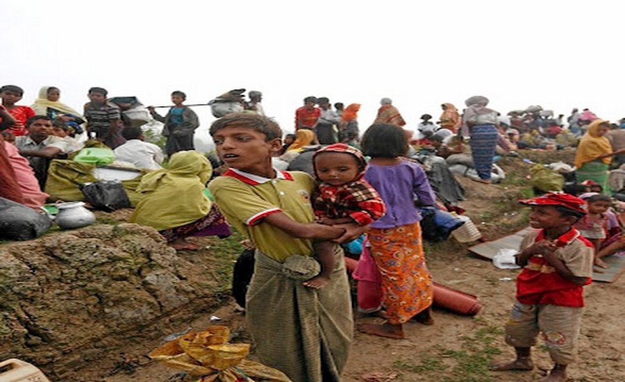
About 3 miles (5 km) from the Naf River that marks the border between Myanmar’s Rakhine state and Bangladesh, Kan Kya was home to hundreds of people before the army chased 730,000 Rohingya out of the country in 2017 in what the United Nations described as “a textbook example of ethnic cleansing.”
The Myanmar military, now facing charges of genocide, said it was conducting clearance operations targeting militants.
Where Kan Kya once stood, there are now dozens of government and military buildings including a sprawling, fenced off police base, according to satellite images publicly available on Google Earth and historical images provided to Reuters by Planet Labs. The village, in a remote region in the northwest of the country closed off to foreigners, was too small to be named on Google Maps.
On maps produced in 2020 by the United Nations mapping unit in Myanmar, which it says are based on Myanmar government maps, the site of the destroyed village is now nameless and reclassified as part of nearby town Maungdaw. The unit makes maps for the use of UN bodies, such as refugee agency UNHCR, and humanitarian groups that work with the United Nations in the field.
Kan Kya was one of almost 400 villages destroyed by the Myanmar military in 2017, according to satellite images analysed by New York-based Human Rights Watch. And it is one of at least a dozen whose names have been erased.